
Rosa Schwarz · 13 October 2026
Historical Minutes Connect to Evolving Farm Yields and River Monitoring Data in Brightfeld
Archivists completed the digitization of Brightfeld council meeting minutes spanning from 1975 through 2015, and analysts have begun matching entries about land use decisions with contemporary statistics on crop volumes and livestock numbers. These records detail discussions on zoning changes, irrigation approvals, and early environmental concerns, while current farm output data collected through regional cooperatives show measurable shifts in wheat, barley, and dairy production across the same districts. Researchers note that minutes from the 1980s frequently reference concerns over soil erosion along specific river bends, and satellite-derived yield maps from 2024 through 2026 display corresponding reductions in productivity on those parcels.
October 2026 brought the release of the latest river habitat assessment, compiled by local biologists who sampled macroinvertebrate populations and water quality parameters at twelve fixed stations. The report lists nitrate levels, temperature readings, and fish species counts that align with patterns first flagged in council sessions from the mid-1990s when agricultural runoff became a recurring agenda item. Data from the same stations indicate that sections discussed for buffer strip installation in 1997 now exhibit improved dissolved oxygen readings compared with adjacent reaches lacking those interventions.
Matching Archival Entries to Agricultural Statistics
Farm output figures released quarterly by the regional agricultural extension office track hectares under cultivation, average yields per hectare, and total tonnage delivered to processing facilities. When these numbers are overlaid on maps derived from the archived minutes, observers identify clusters where earlier approvals for drainage improvements coincide with sustained higher barley output through 2025. Conversely, parcels mentioned in 2003 minutes as sites of repeated flooding complaints show persistently lower wheat yields in the most recent harvest reports. Analysts cross-checked these correlations against weather station records to isolate the influence of historical land management choices from seasonal rainfall variation.
One dataset released in late 2025 covers dairy herd sizes and milk volumes per farm; it reveals that operations referenced in 1989 minutes for adopting rotational grazing practices maintained steadier output levels during the 2024 drought period than neighboring farms without similar records. The extension office continues to update these tables monthly, allowing ongoing comparison with the digitized minute indices that now tag every mention of agriculture, water, or land use.
River Habitat Monitoring Integration
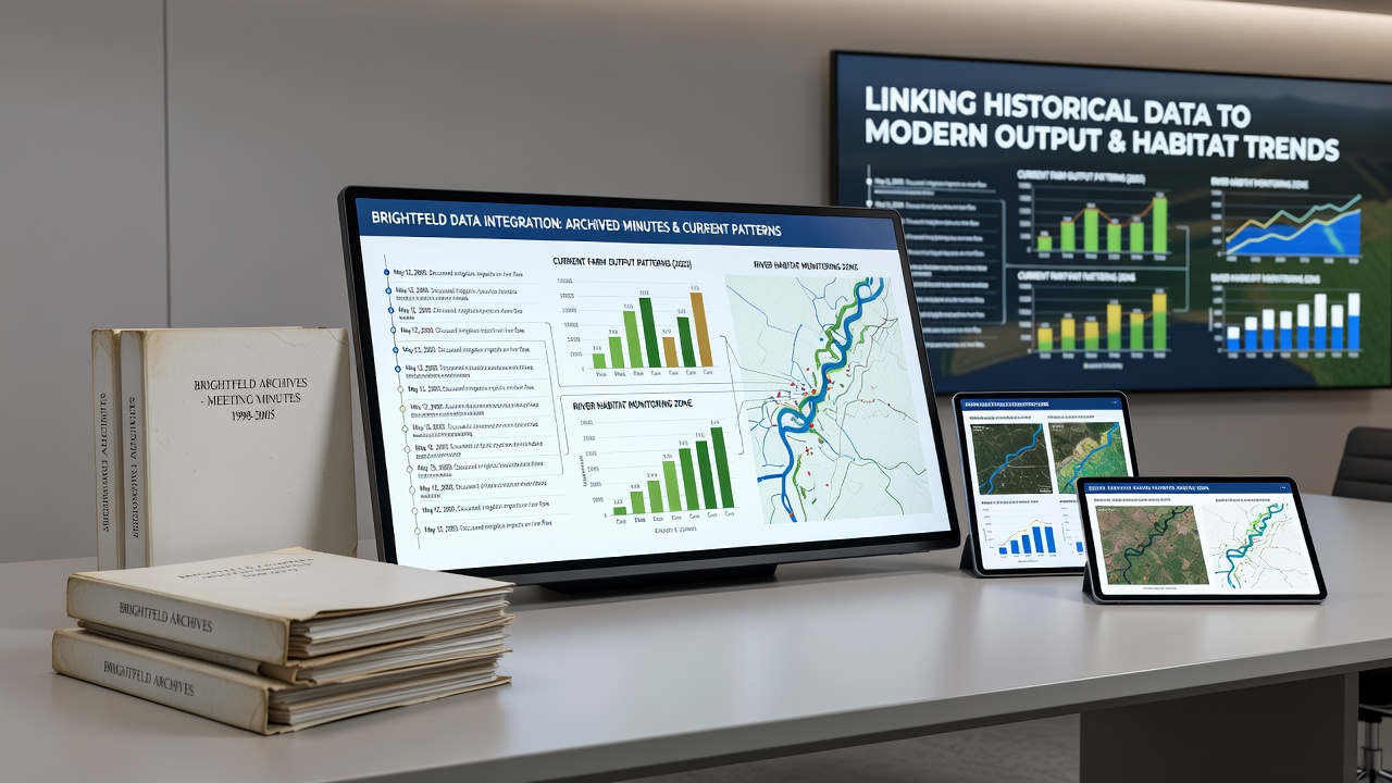
River monitoring teams deploy continuous sensors and conduct seasonal electrofishing surveys, and their protocols now incorporate keyword searches through the archived minutes to prioritize sampling locations. Minutes from 2008, for example, record a vote to restrict fertilizer application near one tributary; habitat data collected since 2020 at that site show lower phosphorus concentrations than at control sites further downstream. The monitoring program, expanded in 2024, adds quarterly macroinvertebrate counts that researchers compare directly with earlier qualitative descriptions found in the council records.
Figures released by the regional water authority in October 2026 list average summer temperatures at each station alongside historical notes on shade tree planting initiatives discussed in 1994. Reaches where those plantings occurred display temperature reductions of 1.2 to 1.8 degrees Celsius relative to unshaded sections, matching the spatial pattern predicted by the archived discussions. These temperature differences correlate with higher counts of cold-water macroinvertebrate taxa at the planted sites.
Cross-Referencing Methods and Data Sources
Researchers developed a tagging system that assigns each minute entry a geographic coordinate and thematic label, then match those tags against GIS layers of current farm boundaries and river sampling points. This process relies on open data standards published by the European Environment Agency, which supplies consistent river habitat classification frameworks used across member states. The same framework allows direct comparison of Brightfeld readings with datasets from other river basins that adopted similar buffer policies in earlier decades.
Additional context comes from agricultural statistics maintained by the Australian Bureau of Agricultural and Resource Economics and Sciences, whose long-term yield series help calibrate models that separate policy effects from broader market or climate influences. Analysts apply these calibrated models to the Brightfeld dataset to estimate how much of the observed yield variation traces to decisions documented in the minutes rather than external factors.
Current Applications and Ongoing Updates
Planning staff now consult both the digitized minutes and the live monitoring dashboards when reviewing new development proposals. A permit application submitted in September 2026 for expanded irrigation infrastructure triggered an automated search that surfaced 1992 minutes discussing downstream habitat sensitivity; the resulting review incorporated updated fish population data before issuing conditions. This workflow continues to evolve as new sensor readings arrive and as additional minute volumes receive full optical character recognition processing.
Quarterly reports issued by the combined agriculture and environment working group summarize these linkages in tabular form, listing each active farm parcel, its yield trend since 2020, and any river station within five kilometers that shows correlated habitat metrics. The reports remain publicly accessible through the regional data portal, enabling further analysis by external researchers.
Conclusion
The integration of archived meeting minutes with current farm output patterns and river habitat monitoring produces a continuous record that spans five decades of land and water management in Brightfeld. Monthly updates to both agricultural statistics and biological sampling data allow analysts to test hypotheses generated from historical entries against fresh measurements, and the process now operates on a routine schedule supported by standardized tagging and open data protocols. Future releases scheduled for 2027 will incorporate additional sensor networks and further refined coordinate matching, extending the same comparative approach to new variables such as soil carbon levels and riparian vegetation indices.